Pikialasorsuaq Atlas
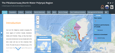
 The Pikialasorsuaq Atlas is an online, interactive atlas with several ArcGIS layers, which was created in a collaboration between WWF as part of their Last Ice Area, KNAPK (The Association of Fishers and Hunters in Greenland), ICC Greenland and ICC Canada with the help of the Dalhousie University in Canada.
It features the indigenous knowledge collected by the Pikialasorsuaq Commission during their consultation trips in April and September 2016 to Inuit communities in Nunavut and Northwest Greenland surrounding the Pikialasorsuaq. Several members from each community were interviewed about their knowledge on the Pikialasorsuaq and surrounding habitats, the ecosystem, and their past and present use of the living resources. The atlas incorporates both indigenous knowledge and scientific knowledge from different sources (e.g. the Piniariarneq Project in Greenland and the Inuit Land Use and Occupancy Project in Canada).
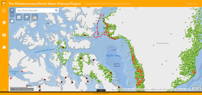
 The Pikialasorsuaq Atlas also features an online Planning Tool that allows the user to explore how different activities and resources may overlap and interact (e.g. how exploration activities may overlap with marine mammal habitat). Different layers can be added or removed, and additional databases can be added to tailor the needs of e.g. researchers and planners.
Both the interactive atlas and planning tool are hosted on the Esri Managed Cloud Services through an account owned by WWF.